
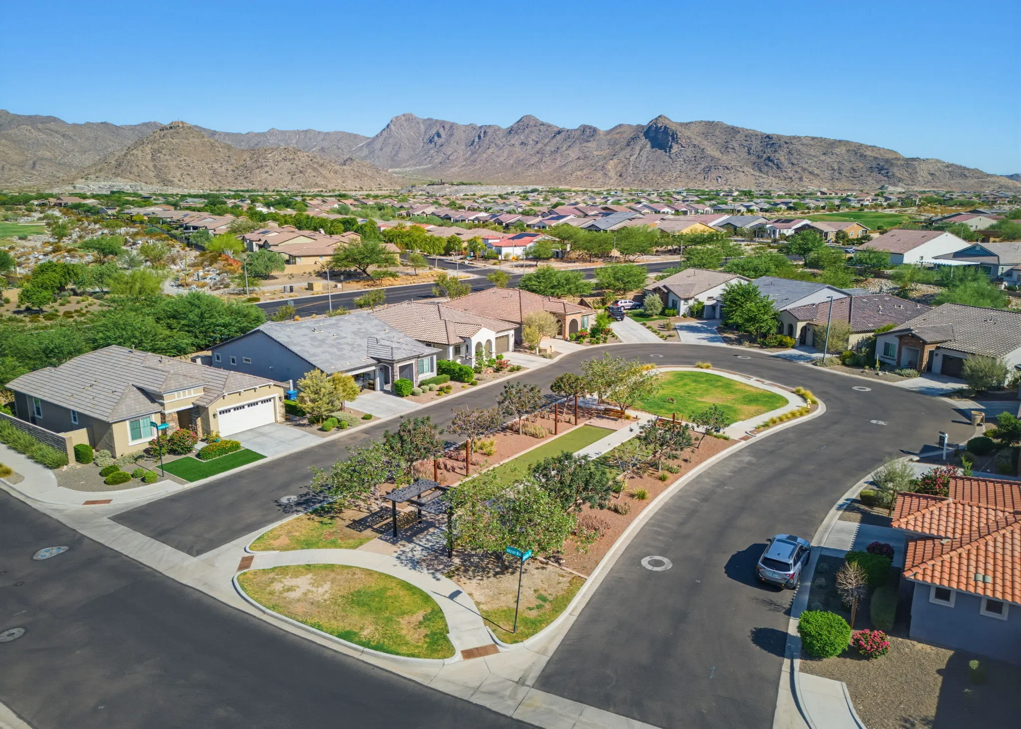
Real estate drone photography in Scottsdale
Aerial photos that show what a Scottsdale listing actually sits on: the lot, the views, the fairway out back, and how close it is to the preserve. Flown by an FAA Part 107 certified pilot who handles the airspace authorization before the shoot.
- FAA Part 107 certified
- ARMLS Certified Photographer
- Zillow Showcase certified
- Licensed and insured
What buyers can't see from the curb
In Scottsdale, a lot of a home's value sits past the front door. A street-level exterior can't show a half-acre lot backing onto a fairway, a pool deck facing Pinnacle Peak, or a short walk to the greenbelt.
Aerials put the home in context, so buyers understand the property before they ever schedule a showing.

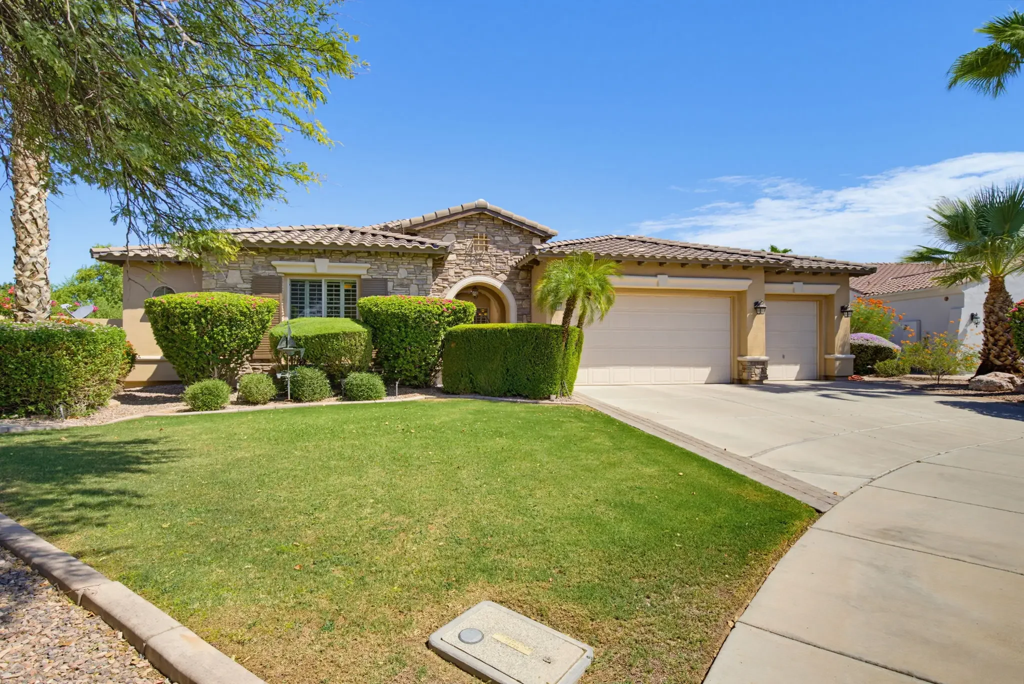
Drag the slider to compare the same Scottsdale listing from the street and from the air.
Aerials shot for the part of Scottsdale you're listing in
Scottsdale stretches more than 30 miles north to south, and what sells a home changes along the way. We plan each flight around what buyers in that area are paying for.
North Scottsdale
Troon North, Desert Mountain, Pinnacle Peak, Silverleaf, DC Ranch
Bigger lots, desert setbacks, and mountain views. Aerials show the full acreage and where the home sits against Pinnacle Peak, Troon Mountain, or the McDowells.
Central Scottsdale
McCormick Ranch, Gainey Ranch, Scottsdale Ranch
Lakes, greenbelts, and golf. We frame the home with the community amenities around it, so buyers see the setting along with the house.
Old Town and South Scottsdale
Old Town, the Waterfront, Arcadia-adjacent infill
Location does the selling here. A higher vantage point shows how close a condo or infill home is to Old Town dining, the canal, and Camelback Mountain.
Kierland, Grayhawk, and the Airpark
Near Scottsdale Airport
These neighborhoods sit inside Scottsdale Airport's controlled airspace. We request FAA authorization before every flight here, so your aerials are legal to fly and legal to publish.
Scottsdale airspace, handled before the shoot
Scottsdale Airport is a towered airport, and its Class D airspace covers the Airpark and the neighborhoods around it. Flying a drone there for a listing requires FAA authorization, which we request through LAANC, the FAA's system for approving flights in controlled airspace.
We check every Scottsdale address before the shoot. Temporary flight restrictions also pop up around large events in town, and we check for those on shoot day. If a property can't be approved at an altitude that makes for useful aerials, we'll tell you ahead of time instead of showing up and grounding the drone.
How drone fits into your Scottsdale shoot
Add aerials to a full listing shoot, or book them on their own if you already have interior photos.
Scottsdale drone photography questions
Does a drone photographer in Scottsdale need a license?
Yes. Flying a drone for a paid listing is commercial use, which requires an FAA Part 107 remote pilot certificate. We hold one and carry liability insurance.
Can you fly near Scottsdale Airport?
Often, yes, with FAA authorization. We request it for every address in controlled airspace before the shoot. If a property can't be approved, we'll let you know ahead of time.
Can I book drone photos without a photo package?
Yes. Aerial photos can be booked on their own.
Do you offer drone video by itself?
No. Drone video is included in our video packages when the airspace allows it, but it isn't sold separately.
Which parts of Scottsdale do you cover?
All of it, from South Scottsdale up through Desert Mountain, along with the rest of the Phoenix metro.
Put aerials on your next Scottsdale listing
See packages and add-ons, then book the shoot online. We'll confirm the airspace for your address before the flight.
